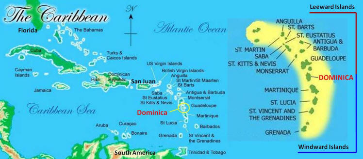
Salybia Mission Project
  • Home
  • About SMP
  • The Clinic
    • Visit Salybia Clinic
    • Videos
  • The Kalinago
    • About
    • In The News
  • About Dominica
    • The Nature Island
    • Facts & Information
    • Locate Dominica
  • SMP History
    • Our Beginnings
    • SMP Voices
    • Our Projects
    • Donors & Sponsors
    • SMP Recognition
    • John Hawley
    • Newsletters
Locate Dominica

Location
The island's coordinates are 
15.20N,  61.19W  

The Salybia Mission is located just a few minutes south of Marigot along the island's east coast.

Dominica is about 1,400 miles southeast of Miami, 400 miles southeast of San Juan, 400 miles north of Venezuela and 1,500 miles west of Central America. The Caribbean Sea expands to the west, the Atlantic Ocean to the east.  

Dominica is approximately 29 miles long and 16 miles at its widest point; its area is 289.5 sq. miles. 

Dominica is the dividing point of the Caribbean islands' Windward islands to the north and the Leeward islands to the south.  ​
Picture
E-mail Us
  • [email protected]
Picture
Site Updated 11-22-23
Website by Limestone9Consulting.com

  • Home
  • About SMP
  • The Clinic
    • Visit Salybia Clinic
    • Videos
  • The Kalinago
    • About
    • In The News
  • About Dominica
    • The Nature Island
    • Facts & Information
    • Locate Dominica
  • SMP History
    • Our Beginnings
    • SMP Voices
    • Our Projects
    • Donors & Sponsors
    • SMP Recognition
    • John Hawley
    • Newsletters